Best of the
Best
Editors' picks and our top buying guides


Best of the
Best
Editors' picks and our top buying guides
Latest

Want Better Skin? Here's How to Naturally Boost Your Body's Collagen Levels
10 minutes ago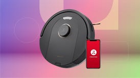
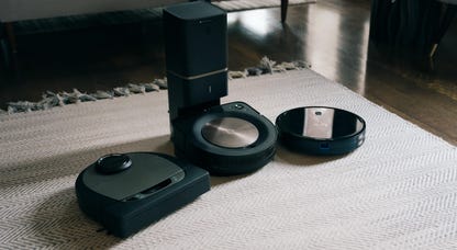
Save $130 on the 2-in-1 Roborock Q5 Pro Robot Vacuum and Mop
15 minutes ago
Best Mattress for Back Sleepers in 2024
18 minutes ago
Best Sheets of 2024
18 minutes agoGrab This Two-Pack Smart Plug for Less Than $20
22 minutes ago
Best Eco-Friendly Cards for April 2024
27 minutes ago
Here Are the Best Ways to Reheat All of Your Leftovers
33 minutes ago
You Can Now Get Unlimited Whole Foods' Deliveries for $10 a Month
38 minutes ago
Arsenal vs. Chelsea Livestream: How to Watch English Premier League Soccer From Anywhere
48 minutes ago
Nab a Massive $110 Discount on the Impressive Ninja Foodi Smart XL
54 minutes ago
Did You Miss the New 'Bluey' Episodes? Here's How to Watch 'The Sign' and 'Surprise'
58 minutes ago
DJI's Mini 3 Drone Is Now Yours for a New Low Price of Just $549
1 hour ago
Best Savings Rates Today -- Don't Miss Out On APYs This High, April 23, 2024
1 hour ago
Best CD Rates Today -- Don't Wait to Snag APYs Up to 5.35%, April 23, 2024
1 hour ago
Upgrade Your Home Theater With This Discounted Samsung S95C OLED TV
1 hour agoMore to Explore
Reviews, advice and more from CNET's experts.


Get the best price on everything CNET Shopping helps you get the best prices on your favorite products. Get promo codes and discounts with a single click.
Add to Chrome - it's free!
Our Expertise
Expertise Lindsey Turrentine is executive vice president for content and audience. She has helped shape digital media since digital media was born.
0357911176
02468104
024681024
Featured in
Tech


Upgrade your inbox
Get CNET Insider
From talking fridges to iPhones, our experts are here to help make the world a little less complicated.
Featured in
Money


Crossing the Broadband Divide
Millions of Americans lack access to high-speed internet. Here's how to fix that.


Featured in
Energy and Utilities


Deep Dives
Immerse yourself in our in-depth stories.


Get the best price on everything CNET Shopping helps you get the best prices on your favorite products. Get promo codes and discounts with a single click.
Add to Chrome - it's free!
Featured in
Internet


Sleep Through the Night
Get the best sleep of your life with our expert tips.


Get the best price on everything CNET Shopping helps you get the best prices on your favorite products. Get promo codes and discounts with a single click.
Add to Chrome - it's free!
Tech Tips
Get the most out of your phone with this expert advice.


Get the best price on everything CNET Shopping helps you get the best prices on your favorite products. Get promo codes and discounts with a single click.
Add to Chrome - it's free!

Featured in
Home


Living Off Grid
CNET's Eric Mack has lived off the grid for over three years. Here's what he learned.